Annapurna Round Trek
Annapurna Round Trek
Info
Central Nepal is dominated by the Annapurna Himal. Annapurna round is the most popular route of this area. Visit the Tibet like country on the northern slopes of the Himalaya and the dramatic Kali Gandaki gorge. Nepal opened Manang to trekkers in April 1977. You walk completely around the Annapurna massif. Trek through lowland villages to the remote Manang region, and down the Kali Gandaki. Cross a 5416m pass called “Thorang la”. There are many tea shops and lodges all along the route from Besi Shahar to Pokhara. There are also many good camping grounds on the way. You walk along the Marshyangdi valley to Thorung Fedi, cross Thorung pass and then drop down to the Muktinath and then follow kali Gandaki valley from Kagbeni. There is an airport in Jomsom. If you don’t have enough time you can fly to Pokhara from here or can continue your trek along the Kali Gandaki valley to Tato Pani, Ghorepani or drive from Jomsom to Beni and Pokhara.
Trip Facts
- Duration: 16 days
- Type of the Trek: Tea House, Camping
- Activities: Trekking, Culture Tours
- Best Months: September to November and March to May
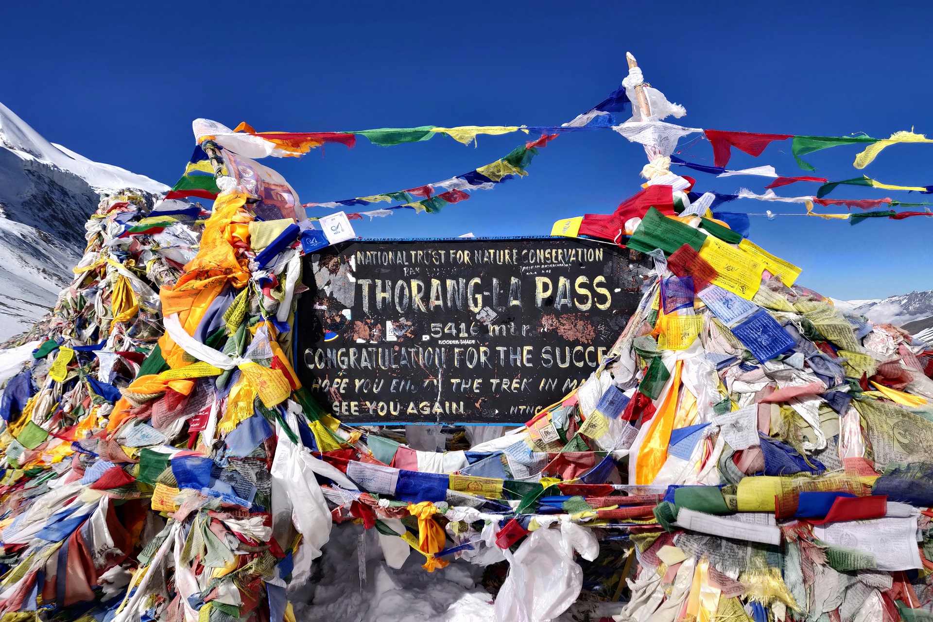
- Maximum Altitude: 5416m (Thorang Pass)
- Grade: Medium to hard
Trip Highlights
- Walk completely around Annapurna massif.
- Trek through lowland villages to the remote Manang region and down the Kali Gandaki.
- Magnificent views of Annapurna, Manaslu and Dhaulagiri range.
- Experience different culture and visit ancient monasteries.
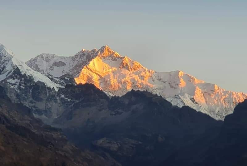
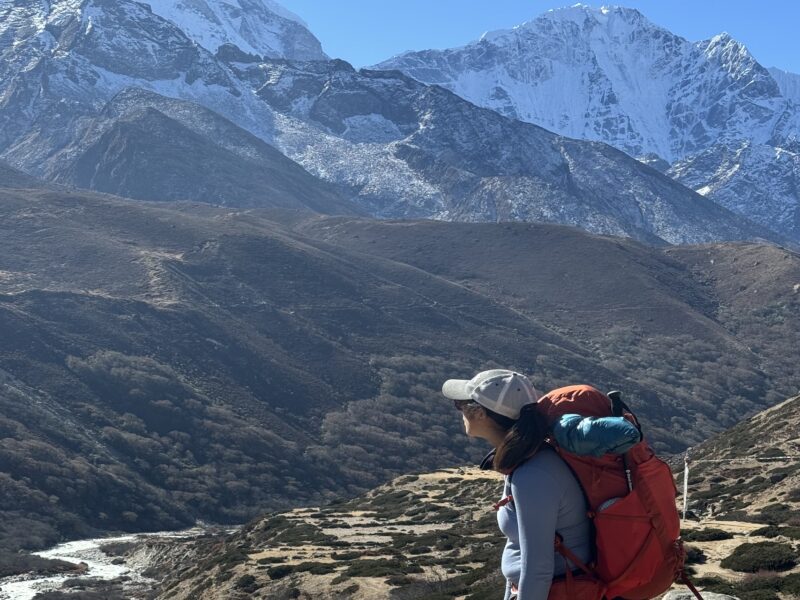
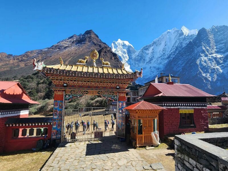
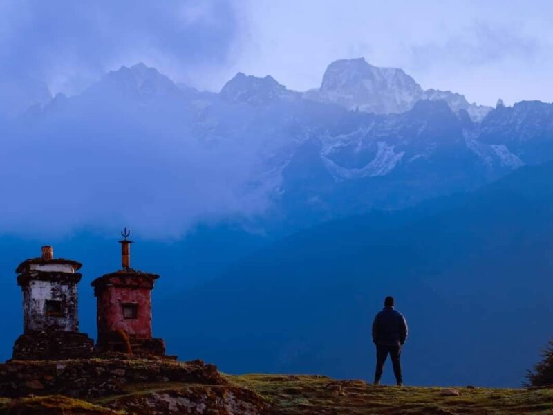
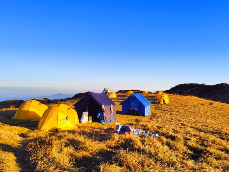
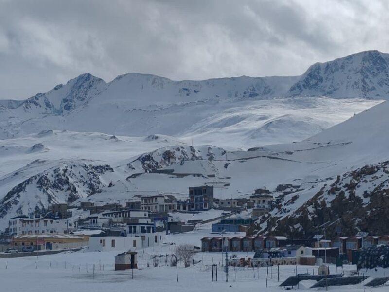
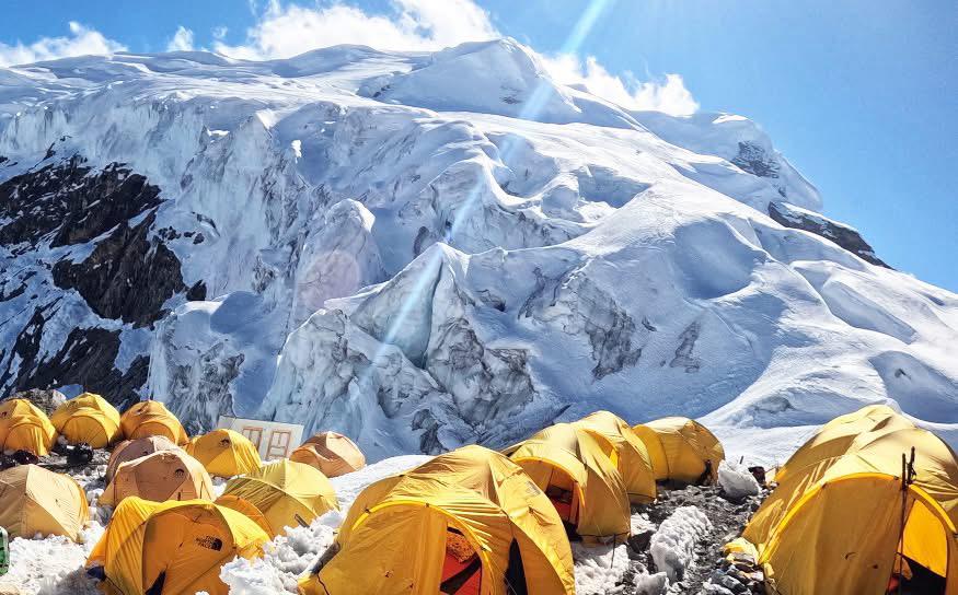
Some Glimpse Photo of Trips
Day 1: Arrive in Kathmandu (1350m)
A representative from the company will display your naming board and greet you outside the arrival terminal. He or she will answer questions, brief you on the immediate arrangements escort to your hotel. The trip leader will hold a short briefing in the hotel regarding trek arrangements and a general orientation to Kathmandu.
Day 2: Sightseeing around Kathmandu valley
Our Tour guide led you explore around Kathmandu valley for the sightseeing. We explore historical, spiritual and world Heritage Sites: Kathmandu Durbar Square, Swayambhunath (Monkey temple), and Bouddhanath: one of the largest Stupa of the world. In the afternoon, we visit Bhaktapur city, one of the oldest city of Nepal and very popular for its pottery square and old temples.
Day 3: Drive to Chamje (1430m / 9 hrs)
We begin our journey early in the morning around 7 am. After breakfast we take private transportation for the drive to Chamje, trek starting point. As soon as you drive out of the Kathmandu valley you get panoramic views of the Annapurna, Manaslu and Ganesh Himal. As you descend the scenic winding road, the mountain views disappear and you drive along the Trishuli River before turning west at Mugling and drive against flow of Marshyangdi River. We stop in one of many wayside restaurants for lunch. Upon reaching the tropical town of Dumre, we leave the main road and take a narrower road going north and follow the west bank of Marshyangdi River with the view of tumbling white water, terraced hillsides and a beautiful mountain panorama to Besishahar. Besishahar is head quarter of Lamjung district. Here are many government offices, hotels, restaurants and shops. This is big town. From here we change the local 4 wheeler jeep and drive along the dusty and bumpy road to Chamje. The road is very rough. Here are several hotels and shops in Chamje (4 hrs).
Day 4: Trek to Dharapani (1860m / 6 hrs)
Beyond the Chamje, we descend down and cross the Marshyangdi to the east bank and follow the trail along the river (5 min) embankment on rocks and exposed wire. There is a waterfall in the other side. The trail passes under an overhanging rock, and then climbs a rocky trail (20 min) and a steep stone staircase to a bhattis in Sattale. Climb past fields, then through stands of bamboo and mixed trees to an exposed trail that traverses high above the steep river bank. The trail makes a short descend to Tal Phedi, here is a local tea shop at 1580m. From here it is steep climb for a while and arrives at the small top. The trail crests a ridge and the valley suddenly opens into a large plateau. In these dramatic settings, at a foot of large waterfall, is Tal, at 1675m (3 hrs from Chamje). The road continues other side of the valley and joins just before Ningal ghari. There are many shops, lodges and very nice camping ground In Tal. Tal means “lake”. Tal is the southernmost village in Manang and it is the starting point of Manang district. The trail crosses the broad flat valley through fields of corn, barley and potatoes, and then crosses a small stream on a wooden bridge. There is a short climb, and then the trail makes its way along a cliff and along the riverbed to Siran Tal. A short distance beyond it climbs to long suspension bridge across the Marshyangdi River and join with road. From here we follow the road and ascend to Ningal ghari. There are some simple tea shops. Follow the road that has been blasted out of the side of the cliff past 2 waterfalls to the Khotro. There are some normal hotels on the way. We leave the road and cross the river by long high suspension bridge and arrive in Karte (2 hrs from Tal). We follow up a stone staircase and over a ridge behind Karte then drop to a suspension bridge. The trail climbs from the bridge for a while, join with road walk through stone Kani that marks the entrance to Dharapani at 1860m (30-40 min from Karte). This village is divided in to 2 parts, lower and upper . There are many good lodges, shops, police check post and some camping ground in this village.
Day 5: Trek to Chame (2690m / 6-7 hrs)
From Dharapani, we follow the rough road all the way to Bagarchhap (2160m / 30-40 min). It is very easy flat and gentle ascend through beautiful forest. This is the first village on the trek with typical Tibetan architecture closely spaced stone houses, with flat roofs pilled high firewood. Here are several shops and guesthouses. We continue follow the road towards west up the Manang valley with the high Himalayan peaks to the south. And if you look down the valley to the west, Manaslu and peak 29 dominates the skyline. The rough road ascends gently through forests to Danakyu a settlement at 2190m with several hotels (30-40min). From here we follow the road for a while to last corner to a bridge near a spectacular waterfall then traverse a rock ledge. Climb over a ridge on a steep rocky trail through beautiful forest. We meet the road but we use short cut old path. After the second short cut, we follow the road, walk through mini hydro power house and climb up to the first small village of Temang and then continue to climb for 15 min to main settlement to Temang (3639m / 1 hr 30-40 min from Danakyu). This is very nice place, here are many nice hotels and offer wonderful views of Manaslu Range. After Temang we walk along the road, it is very easy and flat route to first Thanchok / Serku / 30 min). Here are also some hotels. From here, we take short cut and walk through some fields. We descend down to a river, cross it by long suspension bridge and climb up to the main Thanchok village (2682m / 40 min). This is large village we have very nice view of Manaslu range also from here. From the end of this village, we follow the rough road all the way to entrance Chorten of Koto (2635m / 1 hr), it is also known as kyupar in a meadow surrounded by huge pine and spruce trees. Here are several lodges, shops and camping ground in this village. The police check post here controls access to the Nar-Phu valley to the north. We have very nice view of Annapurna II from before Koto and it is very easy and enjoyable walk. From Koto it is 30 min easy walk to Chame (2690m). Chame is the administrative headquarters for the Manang district. At the entrance to the village is a long Mani wall with many prayer wheels. Here are many good hotels, shops, school, health post and bank. Across the river there are two small hot springs. We have views of Lamjung Himal and Annapurna II.
Day 6: Trek to Pisang (3200m / Upper – 3295m / 5-6 hrs)
From the bridge we pass an older part of Chame and the Kani. We walk along the road, gently ascend and climb past Mani walls to a huge walled in field of buck wheat in the village of Talekhu (2790m / 25 min). After this village it is long pleasant, mostly level walk along the road in forests with one short landslide crossing, to a huge apple orchard to Bhratang (2854m / 1 hr 40-50 min from Talekhu). In Bhratang, there are some hotels and apple farm. The valley is steep and narrow and the road goes through deep forests. We have nice view of Annapurna II to the south. When the road rounds a bend, there is the first view of the dramatic Pangdi Danda rock face. Cross to the south bank of the Marshyangdi on a suspension bridge (2931m / 25-30min), climb up by old trail through beautiful forest, passes some local tea shops over a ridge then follow the road, flat route to Dhikur Pokhari, named after a tiny lake nearby (1 hr / 3192m from bridge). The trek is then reasonably level as it heads into the upper part of the Manang valley, eventually reaching at the entrance to Pisang. The lower portion of Pisang is a cluster of houses and a long Mani wall with prayer wheels. There are many hotels and shops. There are excellent camping places in the forest on the south bank of the river. The main village of Pisang is across the river and 100m uphill. Pisang is situated at the foot of Pisang peak.
#For upper Pisang, after Dhikur Pokhari turn to the right hand side and fallow the small path. It is gradual descend and flat. We cross the Marsyangdi River, follow the flat wide path through beautiful grounds, there are growing lots of Juniper and pine trees. The path gently ascends to upper Pisang village (1 hr). We have wonderful views of Annapurna II and the valley. Upper Pisang is much better for mountain and the valley views. Here are some hotels.
Day 7: Trek to Manang (3540m / 7 hrs)
Passing some prayer wheels and irrigation canals we ascend gradually to a pass (3380m) from where a wide Manang valley comes in full view with peaks of Chulu East (6429m) on the north and Gangapurna (7454m) in the south. After a short descend the trail reaches the broad forested floor. Most of the valley is used as grazing land for sheep, goats, horses and Yaks. Across the river high on the northern bank is Ghyaru. The trail follows along the valley floor to Manang’s airstrip at Humde, elevation 3325m. Here are several hotels, curio shops and police check post. There are scheduled flights from Humde to Pokhara and occasional direct flight to Kathmandu. We are now in the alpine zone with scattered scrubs of juniper. The soils here are poor and only one crop per year of wheat, barley, buck wheat and potatoes grows. Half an hour beyond the airport is the huge Subje khola valley with Annapurna- III and –IV at the head. The trail crosses to the north bank of the Marshyangdi on a wooden bridge near Mungji. The snow peak at the head of the valley is Tilicho peak, to the north of it s a black rock spire named Khangsar (5977m). The route climbs past fields of barley over a low ridge to Braga at 3475m. Here are many hotels and ancient monastery perched high on the valley cliff. The country is very arid, dominated by weird cliffs of yellow rock, eroded into dramatic pillars alongside the trail and by the towering heights of the Himalaya across the valley to the south. It is an only short walk past Mani walls and across a stream where several mills graind wheat and barley to the plateau of Manang village at 3540m. Here are many good hotels with very good facility. Here are lots of trekking shops, The Himalayan Rescue Association with a doctor. The village itself is a collection of many flat-roofed houses. But now here are many modern concrete buildings. The setting of the village is most dramatic with the summits of Annapurna and Gangapurna less than 8 km away and a huge icefall rumbling and crashing on the flanks of the peak. Here are several good camping grounds in the village and out of the village near water tank.
#Now, there is the road all the way to Manang. We walk along the road.
Higher route via Ghyaru and Ngawal:
We walk through middle of the upper Pisang village passing several Mani walls and Stupas. It is flat, gradual ascend and descend through beautiful Pine and juniper forest. We have wonderful views of Annapurna II and other peaks including valley. After very easy 1 hr walk, arrive in very old long Mani wall. Few minutes later, we cross river by long suspension bridge and then climb steep up by making many switch backs to Ghyaru (3695m / 1 hr from bridge). When we get higher the views of the mountains and the valley become very nice. Gyaru is large village. Here are many hotels and beautiful rest place in the beginning. We have super views of Annapurna II, Annapurna III, Gangapurna, Tilicho, Pisang peak and the valley from here. The rest place is best point to see views and drink some tea. Here are many old Stupas and Mani walls in this village.
From Ghyaru, the path is very easy flat route to Ngawal but there are also some small short climbs on the way (3640m / 2 hrs). It is very nice walk and the views are superb. We pass many old Mani walls and Stupas. Ngawal is also a large village. Here are many hotels, Mani walls and Stupas. Chulu East is at just head of the village. We join with small rough road before this village.
Leaving Ghyaru, we follow the small dusty road and descend down to the valley floor, opposite side of Humde (3443m / 25 min). We follow the road and gradually ascend, flat through beautiful Pine forest and join with main Humde road at Mungji (3463m / 1 hr from bottom). From here, walk along the road and arrive in Braka (3470m / 20 min). Here are many good hotels, Buddha garden and the monastery is on top of the village. After Braka continue to follow the rough road for 20 min and gently ascend to Manang village. We walk through many Mani walls and Stupas.
The village of the Manang lies at the foot of the northern side of the Annapurna range. People and culture here are of Tibetan origin. The rain shadow caused by the Himalayan range deprives the valley of rain and as a result life here is harsh. People here depend on poor soil, sheep and Yak for a living. However with tourism the fates of people have changed. Mostly people have very good income from tourism. The view of the Annapurna ranges from here is incredible with Annapurna-II, Annapurna-IV, Annapurna-III, Gangapurna and Tilicho Peak forming a massive chain.
Day 8: Manang (Acclimatize and explore)
An extra day in Manang we can hike to the monastery high above for the view of the valley or to the lake below the Gangapurna glacier.
Hike to the Gangapurna lake and the view point, we descend down to river by the side of new Stupa in front of ACAP check post. Cross the river by bridge and gradually ascend to the lake (20-25 min / 3517m). The view of the Lake, Gangapurna peak, glaciers, Annapurna III and Tilicho are superb. After visit the Lake, we come back little bit then climb steeply up by side of the moraine wall then Pine forest. There is very good path, climb up by making several switch backs to flat top / view point (3753m / 1hr). There is a small tea shop. From here we can see fantastic view of Annapurna II, Annapurna III, Gangapurna, Tilicho peak Syagang, Chulu, Pisang peak and some parts of Manaslu.
After enjoying with mountain views we come back down to Manang for hot lunch. In the afternoon we visit around the village.
Day 9: Trek to Yak Kharka (4 hrs) or Churi Ledar (4060m – 4230m / 5 hrs)
From Manang village, the trail cross a stream, join with small road and climb up to Tengi village (3668m / 30 min). There are many Mani walls and Stupas and some hotels. After Tengi we leave the road and follow old trekking path. The trail follows this valley north passing a few Goths as it’s steadily gains elevation. The vegetation now consists of scrub juniper and alpine grasses. The trail gently ascend to the small village of Gunsang at 3930m (1 hr from Tengi). Here are some hotels. The route passes through sparse forests of juniper, rose and barberry and a few meadows where horses and yaks graze. After crossing a large stream that flows from the peaks of Chulu west and Gundang, the trail passes an ancient Mani wall in a pleasant meadow. All the time it is gentle ascend and flat route to Yak Kharka (1 hr 30 min). Here are several good hotels. Mostly tourists spend night here because in Churi Ledar there are just few simple hotels. A large herd of yaks graze in the fields nearby. Here are good grounds for camping near hotel. From here it is small climb and gentle ascend for 1hr to Churi Ledar. There are just few simple hotels and camping ground. We have nice views of Annapurna II, III, Gangapurna, Tilicho peak, Syagang and Chulu west almost for whole day. We cross 2 rivers on the way by suspension bridge.
Day 10: Trek to Thorung Phedi / High camp (4450m / 4870m / 5 hrs)
From Churi Ledar the trail continues to gradual ascend along the east bank of the Jarsang Khola. After 30-35 minutes from Churi ledar, descend and crosses the stream on a new suspension bridge. Make a short ascent on a good trail to a tea shop. The route then follows a narrow trail across a high unstable scree slope and gently ascends to Thorung Phedi, a rock –strewn meadow surrounded by vertical cliffs at 4450m. There are several hotels. Many people schedule to leave from here at 3 am. Blue sheep and even snow leopards sometimes magically appear in this valley. The crow and the large birds can see. We reach in Thorung Phedi on time for lunch; therefore can spend the afternoon relaxing and saving energy for the next day’s climb. There is high camp in Thorung Phedi at 4870m but mostly tourist stay in first camp. Phedi means “foot of the hill” is a common Nepali name for any settlement at the bottom of a long climb. If you are strong and well feel then better to go in high camp. It takes about 40-50 min but this part is very steep. It helps very much for next day.
Day 11: Cross Thorung Pass (5416m), trek to Muktinath (3760m / 8-9 hrs)
From Thorung Phedi trail becomes steep, switch backing up moraines and following rocky ridges as it ascends to the pass. Local people have used this trail for hundreds of years to bring herds of sheep and yaks in and out of Manang. So, the trail is well defined and easy to find. The crossing of the pass is just walk at high altitude and there is no technical problem. But if we are late to start, weather sometimes create problem. Therefore we make an early start. There is a steeper section at the beginning for about an hour after which the walk towards the pass is rather gradual uphill. Now, there are many signs along the way to find path if there is snow. It takes from 4-5 hours from Thorung Phedi to the pass. Thorung La, with its traditional Chhorten, prayer flags and stone cairn is at an elevation of 5416m. There is also a small tea shop on the top. The views from the trail and from the pass are outstanding high Himalayan scenes. You can see the long ridge of high mountains called the “great barrier”. This separates the drier, Tibet like region of Manang from the rest of Nepal. Yakwa Kang (6482m) to the north and Khatung Kang (6484m) to the south. The Mukut and the Mustang Himal lies in the west with the Kal igandaki valley down below. The peaks of Chulu East and Chulu West lies on the north and the entire Annapurna ranges dominate the southern horizon.
Descending down is steep and rough on the knees a loss of more than 1600m in about four hours. There are excellent views of Dhaulagiri standing alone in the distance across the valley. Eventually the moraines yield tom grassy slopes and the final descend to Muktinath is a pleasant walk along the upper part of the Jhong Khola valley. Now there is a new rough road from before the bottom but we use old short cut trail. There are some hotels at Chambar Bhu (4190m / bottom / 2 hrs 30-40 min). From Chambar Bhu, it is 1 and half hours easy walk to Muktinath. We follow a wide trail into Muktinath which is the first village after crossing the pass. We can see wonderful views of Nilgiri, Dhaulagiri and many other peaks. The temple and the religious shrines of Muktinath are about 90 meter from hotel area. It is not allowed to make camp in temple area. Muktinath is an important pilgrimage place for both Hindus and Buddhists. The holy shrines at Muktinath are in a grove of trees and include a Buddhist Gompa and the pagoda style temple of Vishnu mandir, containing an image of Vishnu. Around the temple is a wall from which 108 waterspouts, cast in the shape of cow’s heads, pour underground spring water. There is also a Buddhist temple containing a burning natural gas and a small spring emerging from the rock in the same vicinity. This auspicious combination of earth, fire and water is responsible for the religious importance of Muktinath. There is also a new large Buddha statue. Muktinath is beautiful place where you can enjoy very much. Here are many good hotels, restaurants and shops. Here is also a police and ACAP check post. Now, this place has been connected with motor able road with Jomsom and Beni. We can visit temples in the afternoon.
Day 12: Trek to Kagbeni (2800m / 3 hrs) or Jomsom (4-5 hrs)
We descend towards the kali Gandaki valley through the village of Jharkot back dropped by the sensational view of Dhaulagiri I (8167m) and Nilgiri (7061m). Jharkot is an impressive fortress like village at 3500m. There are several hotels with its picturesque Kani and large Gompa is well exploring. Across the valley we can see the ruins of Dzong, the ancient capital of this region and the smaller villages of Purang and Changur. We walk through the rough road and small trail. Passing the yellow barren landscape with dotted patches of green cultivation, we follow the windy road and after a short steep descend we reach a former trading post of compact Kagbeni on the way to Mustang and to Tibet. Kagbeni looks like a town out of the medieval past, with closely packed mud houses, dark tunnels and alley ways, imposing Chhorten and a large ochre colored Gompa perched above the town. Now here are many new modern buildings. There are many hotels, shops and police check post in the end of the village. The ACAP office that administers upper Mustang is in Kagbeni. Here are some good camping grounds. Kagbeni and Muktinath have been connected with motor able road but the road is rough.
If we don’t have enough time we can go direct to Jomsom from Muktinath or can drive. To go direct Jomsom we can use higher route before descend down to Kagbeni which trail joins at Eklebhatti with Jomsom Kagbeni road. It makes more than 1 hr different.
Note: now the is black topped road from Muktinath to Kagbeni and than rough new road to Jomsom.
Day 13: Trek to Jomsom (2720m / 3-4 hrs)
We head south through a wide, windswept and barren section of the Kali Gandaki valley. We follow the road on the left bank along the floor of the Kali Gandaki River. A little further south we pass through Eklebhatti and still further south we reach dusty and windswept town of the Jomsom in full view of Nilgiri Himal and Dhaulagiri. Jomsom is the administrative headquarter of Mustang district. Jomsom is the gate way to the Mustang valley and Muktinath for pilgrims. Follow the main path past several hotels to the school after then, we cross the Kali Gandaki River by nice bridge. North of the airport, on the west side of the river, are shops, bhattis, shoe repair shops and a large army camp after then we inter into the main market area. There are many nice hotels, restaurants, shops and several airline branch offices. Here is an airstrip in the last part. Many daily flights operate from Pokhara to Jomsom. In this area mostly people are Thakalis. In the afternoon we can visit Jomsom local market.
Day 14: Fly to Pokhara (823m / 15-20 min)
From Jomsom to Pokhara is short flight. During our flight we can see very nice views of the mountains. We will fly along the Kali Gandaki valley and then through the middle of the Annapurna and Dhaulagiri ranges. During the day we can visit many interesting places in Pokhara. Pokhara is the most beautiful town of Nepal and it is surrounded by Annapurna range and nice hills. There are many famous lakes and viewpoints.
Day 15: Fly back to Kathmandu
We fly back to Kathmandu airport and transfer to hotel. In the afternoon we visit the Thamel market for shopping and in the evening we will have farewell dinner at traditional Nepali restaurant with pure Nepali cultural program.
Day 16: Departure to your home
We will transfer you in international airport from hotel for your international flight.
- All airport/hotel transfers
- 3 nights’ accommodation in Normal Nice Hotel in Kathmandu on twin sharing basis including breakfast
- Kathmandu-Lukla-Kathmandu flight and departure taxes
- Food and Accommodation during trekking on full board basis (Breakfast, Lunch & Dinner + Hot Water)
- An experienced English speaking trekking guide, assistant guide and porters to carry luggage including their salary, insurance, equipment, flight, food and lodging
- All necessary paper works (National Park Fee and Trekking Permit)
- Guide the Himalaya: Trekking duffel bag, cap and trekking map
- Insurance for Nepali Staff
- International air fare
- Extra night accommodation in Kathmandu/Lukla because of early arrival, late departure, early return from mountain
(due to any reason) than the scheduled itinerary - Personal trekking gear
- Insurance not Included
- Meals in Kathmandu except breakfast
- Alcohol and Beverages during the trek and climbing season
- Personal expenses (phone calls, laundry, bar bills, battery recharge, shower etc.)
- Emergency Medical Evacuation Cost
- Tips for guides and porters